Location: Mee Waterfowl Production Area
Managed by: Detroit Lakes Wetland Management District
Management Address
26624 N. Tower Road
Detroit Lakes MN 56501-7959
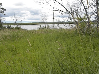
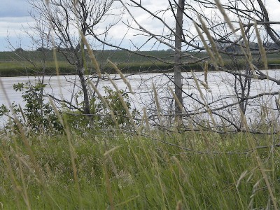
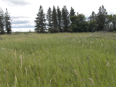
This site is situated in a clearing that overlooks a large slew to the east, prairie grass with an additional slew off in the distance to the west, small hill to north and prairie with clumps of trees to the south. It was developed for deer hunters primarily but could be used to duck hunt as well as to observe nature. Visitors are asked to contact the U.S.F.W.S. to obtain a permit at no cost (218) 847-4431. Detroit Lakes Wetland Management District is located in northwest Minnesota and includes the counties of Becker, Clay, Mahnomen, Norman, and Polk - an area of approximately 6,000 square miles. The district is divided into three general landscape areas, roughly equal in size. From west to east, these are: the Red River Valley floodplain, the glacial moraine/prairie pothole region, and the hardwood/coniferous forest.
Description
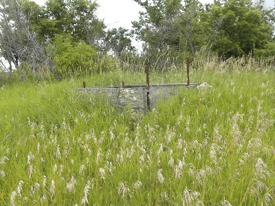
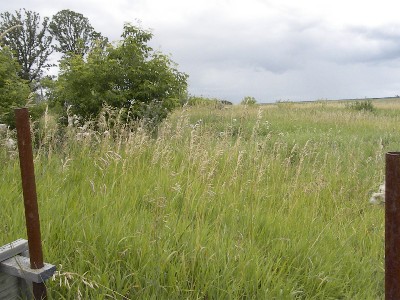
This ground stand is of plywood construction and gives a hunter protection from the elements on three sides. The deck is also plywood. Users may want to bring a tarp to place across the entrance for further protection. People who use wheelchairs will have to drive as close as possible to the stand in order to enter it because there is no accessible path of travel leading to the stand. This site is situated in a clearing that overlooks a large slew to the west, prairie grass with an additional slew off in the distance to the east to southeast, small rise in elevation to north and prairie with clumps of trees to the south. It is designed to give the deer hunter shooting lanes to the south, east and west. The stand looks as though it would be close enough to pass shoot ducks when they are traveling between slews. Views to the north are limited due to the woods and rise in elevation.
The trail leading to the stand goes through the prairie and posed no problem to a two wheel drive vehicle with high ground clearance. This area is very remote once in the stand with very limited cell phone coverage so people are advised to inform others of your destination with a check in time so that they can call for help in case you do not check in. This site is not visited very frequently by any USFWS staff nor can it be seen from the road so it is doubtful anyone would see a person trying to get help.
The USFWS staff would like visitors to request a Special Use Permit prior to accessing the stand so you will have to call (218) 847-4431 or visit the office in Detroit Lakes.
Location Info » For directions, click the marker in the map. »
From Hwy 59 at Winger travel south to Cnty Rd 103 where you will turn east (left) and travel approximately 7.5 miles. On the north (left) a wood pole gate will be seen which will mark the entrance to the site. Users will have to travel to the slew on the left hand side of the trail. An abandoned clearing will be encountered where a farm stead once stood and on the north the stand can be seen.
Amenities
This stand is located in close proximity to both Winger and Fosston, MN. Winger is located along Hwy 59 while Fosston is located along US Hwy 2. Either of these two locations offer the basics with Fosston being a larger community so it has a greater number of specialized stores.
Lodging
The closest community with lodging is Fosston followed by Mahnomen. For persons wanting to gamble Mahnomen offers the Shooting Star Casino which has a hotel as well as camping facilities.
